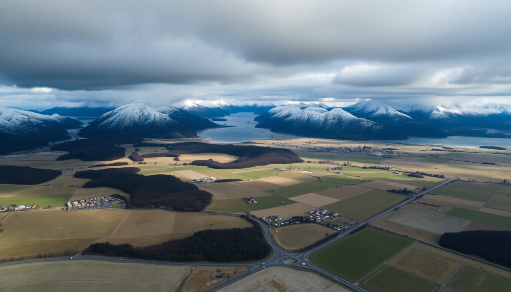
Snow Expected in North and South Islands: Forecast Update
Snow lovers across New Zealand have their eyes on the forecast this week, and for good reason. The MetService is tracking a band of rain moving south that is expected to bring snow to both the North and South Islands, with the lowest freezing levels seen in weeks.
Freezing level (South Island): Approximately 800 m ·
South Island snow showers: A few in the south and northeast ·
North Island snowfall warning threshold: 10 cm in 6 hours or 25 cm in 24 hours below 1000 m ·
Current snow-affected region: Upper South Island and lower North Island ·
Next significant weather event: July 23–24, 2026 (southwesterlies)
Quick snapshot
- South Island snow showers in south and northeast (MetService national forecast)
- Freezing level around 800 m (MetService national forecast)
- North Island band of rain moving south (MetService Facebook)
- July 23–24 disruption with snow (1News report)
- Exact snow accumulation for Christchurch in 2026 (long-range forecast)
- Whether North Island will see snow at low elevations (dependent on temperature)
- Timing of next major snowfall event beyond July 24
- July 22: Band of rain moves southwards over North Island and upper South Island (MetService Facebook)
- July 23–24: Southwesterly winds bring snow lowering to 200 m in Fiordland, Southland, Otago (1News report)
- Next 10 days: Snow forecast maps show accumulations on both islands (snow-forecast.com)
- MetService continues to monitor; road snowfall warnings likely for key alpine passes
- Ski fields in both islands expecting fresh snow accumulation
- Drivers should check MetService warnings before heading into high country
Four key facts about the current snow situation, drawn from official and news sources:
| Measurement | Value |
|---|---|
| Current snow conditions | South Island: a few snow showers in south and northeast. North Island: band of rain moving south, snow below 1000 m. |
| Freezing level | Around 800 m on South Island |
| Next significant weather | July 23–24, 2026 – southwesterlies bring snow to low elevations in Fiordland, Southland, Otago |
| Official warnings | No current severe weather warnings for snow as per MetService |
What is the snow forecast for South Island?
South Island ski field snow forecasts
According to the MetService ski-field forecast (the government weather service for New Zealand), remaining South Island areas saw periods of rain with heavy falls and snow to 1800 metres before easing. For the week ahead, the same forecast indicates a few snow showers in the south and northeast, with the freezing level hovering around 800 m.
MetService official forecast
The national forecast (New Zealand’s official weather authority) on August 15, 2026, said the South Island would be fine in the west and north, with scattered showers elsewhere, mainly in the far south. Marlborough and Canterbury should expect rain turning to showers with snow to about 500 metres. Otago and Southland: occasional showers with snow to about 400 metres. The implication: snow is likely at higher elevations only, but drivers on alpine passes should stay alert.
The freezing level of 800 m means most lower-elevation roads and coastal towns will see rain, not snow. But for those heading to ski fields above 1000 m, fresh snow is almost guaranteed.
The pattern: the South Island forecast shows a clear split — alpine areas get accumulating snow while lowland cities stay on the rainy side of the divide.
Is it snowing in Christchurch?
Christchurch weather now
As of the latest MetService forecast, a band of rain is moving southwards affecting the upper South Island. Christchurch may see rain turning to snow at higher elevations – but not at sea level. The freezing level around 800 m means the city itself is unlikely to see settled snow.
Nearby snow reports
However, the Port Hills and Banks Peninsula could see a dusting. The NZ Herald (a leading New Zealand news outlet) reported road snowfall warnings for Lewis Pass, Arthur’s Pass and Porters Pass – all within a few hours’ drive from Christchurch.
The implication: Christchurch itself stays dry of snow, but the surrounding hills and alpine passes are active snow zones.
Will Christchurch have snow in 2026?
Seasonal snow outlook
The July 23–24, 2026 southwesterly event is expected to bring snow possibly lowering to 200 m about Fiordland, Southland and Otago – not Christchurch directly, according to a 1News report (a trusted New Zealand broadcaster). Christchurch remains on the northern edge of the cold air mass.
Historical snowfall patterns
Christchurch averages one or two light snow events per winter, but they are usually associated with a southerly blast that drops the freezing level below 200 m. The current forecast pattern does not support that, though a later cold snap could change things. The NZ Herald (weather analysis) noted the greatest snowfall in one winter blast was forecast for inland Canterbury and Otago, above about 400 metres – not Christchurch itself.
For Christchurch residents hoping for a snow day, the odds are low this week. But those willing to drive an hour inland to higher ground will find excellent skiing and snowboarding conditions.
The catch: Christchurch snow in 2026 depends on a southerly blast that drops the freezing level below 200 m — something the current forecast does not show.
Where is it currently snowing in New Zealand?
North Island snow
The MetService severe weather outlook (official government warnings) indicates a band of rain moving southwards over the North Island. Widespread snowfall is possible below 1000 m in the central North Island, especially on the Desert Road and Napier-Taupō Road, as confirmed by NZ Herald (road warnings update).
South Island snow
As noted, the South Island is seeing a few snow showers in the south and northeast. The MetService ski fields forecast expects snow to 1800 m on the main ranges. Lower passes like Lewis Pass and Arthur’s Pass have road snowfall warnings active.
Live webcams and reports
For real-time verification, the snow-forecast.com (specialist forecaster) provides live snow depth maps and webcam links for both islands. It’s the best way to see “where is it snowing right now” without waiting for a news bulletin.
The pattern: active snow is concentrated in the central North Island high country and the South Island alpine passes and ski fields.
What is the weather forecast for Christchurch?
Christchurch 14-day forecast
The MetService national forecast shows rain expected for Christchurch over the next few days, with snow only at higher elevations. Daytime highs near 8–10°C and overnight lows around 2°C – cold but not unusual.
Current temperatures and wind
Temperatures in Christchurch are hovering around 6–8°C, with a southerly wind that makes it feel colder. The NZ Herald (weather report) mentioned sleety showers possible from North Canterbury through Marlborough, but again, not settled snow at sea level.
The pattern: Christchurch will stay cold and damp, but the city’s elevation (sea level) and the 800 m freezing level means snow is unlikely. The real action is in the mountains.
Timeline
Here is the sequence of snow-related weather events as reported by official sources and news media:
- – Band of rain moves southwards over North Island and upper South Island (MetService Facebook)
- – Southwesterly winds bring snow lowering to 200 m in Fiordland, Southland, Otago; showers North Island (1News report)
- Next 10 days – Snow forecast maps show accumulations on both islands; check snow-forecast.com for updates
Clarity check
Confirmed facts
- South Island snow showers in south and northeast (MetService national forecast)
- Freezing level around 800 m (MetService national forecast)
- North Island band of rain moving south (MetService Facebook)
- July 23–24 disruption with snow (1News report)
- Road snowfall warnings issued for alpine passes (NZ Herald road warnings update)
What’s unclear
- Exact snow accumulation for Christchurch in 2026 (long-range forecast uncertainty)
- Whether North Island will see snow at low elevations (depends on temperature during rain)
- Timing of next major snowfall event beyond July 24
- Specific road closure details – always check real-time NZTA updates
Quotes from the experts
“A band of rain is making its way southwards over the North Island and upper South Island from Tuesday morning through to Wednesday.”
— MetService, via Facebook (official MetService page)
“Snow possibly lowering to 200m for a time about Fiordland, Southland, and Otago.”
— 1News weather report, August 3, 2026 (1News report)
The NZ Herald (weather report) also noted road snowfall warnings for Lewis Pass, Arthur’s Pass, Milford Road, and Crown Range Road during the July 30 cold spell – a pattern that is repeating now.
Summary
For New Zealanders living in or traveling through the South Island’s alpine passes and the lower North Island, the next 48 hours bring real snow risk. For Christchurch residents, the city will stay on the rainy side of the freezing level, but a short drive inland delivers fresh powder. The bottom line: check MetService warnings before you drive, and if you’re heading to a ski field, the season is delivering.
x.com, snowsure.ai, snowbrains.com, nzherald.co.nz, weather.geek.nz, metservice.com, metservice.com
Frequently asked questions
What is the snow forecast for the North Island?
Widespread snowfall is possible below 1000 m in the central North Island, particularly on the Desert Road and Napier-Taupō Road. A band of rain is moving south, and temperatures are cold enough for snow at higher elevations. Check MetService’s severe weather outlook for updates.
When is the best time to see snow in New Zealand?
July and August are the peak winter months for snow in New Zealand. The South Island typically sees snow down to low levels during strong southerly blasts. Ski fields are open from June to October, but July–August offers the most reliable snow cover.
How accurate are MetService snow forecasts?
MetService is the New Zealand government’s official weather service and uses high-resolution models. Short-term snow forecasts (within 24–48 hours) are highly accurate. Longer-range forecasts (5+ days) carry more uncertainty. Always check official warnings before travel.
What should I do if I am driving in snow?
Reduce speed, increase following distance, use low beam headlights, and avoid sudden braking. Carry snow chains in alpine areas. Check MetService road snowfall warnings and NZTA for road closures before you set off.
Are there any snow-related road closures in New Zealand?
As of the latest reports, road snowfall warnings are in place for Lewis Pass, Arthur’s Pass, Porters Pass, and central North Island roads including Desert Road and Napier-Taupō Road. Actual closures depend on accumulation; check NZTA’s live traffic map for real-time status.
How can I view live snow webcams for New Zealand ski fields?
Webcams are available on most ski resort websites and also aggregated on snow-forecast.com. Check the “Webcams” section for views from Cardrona, The Remarkables, Coronet Peak, Turoa, Whakapapa, and more.
Related reading
More related posts
 Grow a Garden Game – Complete Guide, Tips and Strategies
 Big Save Furniture Christchurch: Reviews, Products & Store Info
 Chicken Road Crossing Game: Play, Win Real Money & 98% RTP
 Seasonal Work Visa NZ 2026: Requirements & Options
 Black Caps Live Score: Official Updates & How to Watch
 Portable CD Player NZ: Be t Pick , Price & Shopping Guide (2026)
 Galaxy Note 9 to Buy in 2026: Price, Worth & Risks
 Auckland Car Dealership Liquidation: Westpac Owed $3.1M