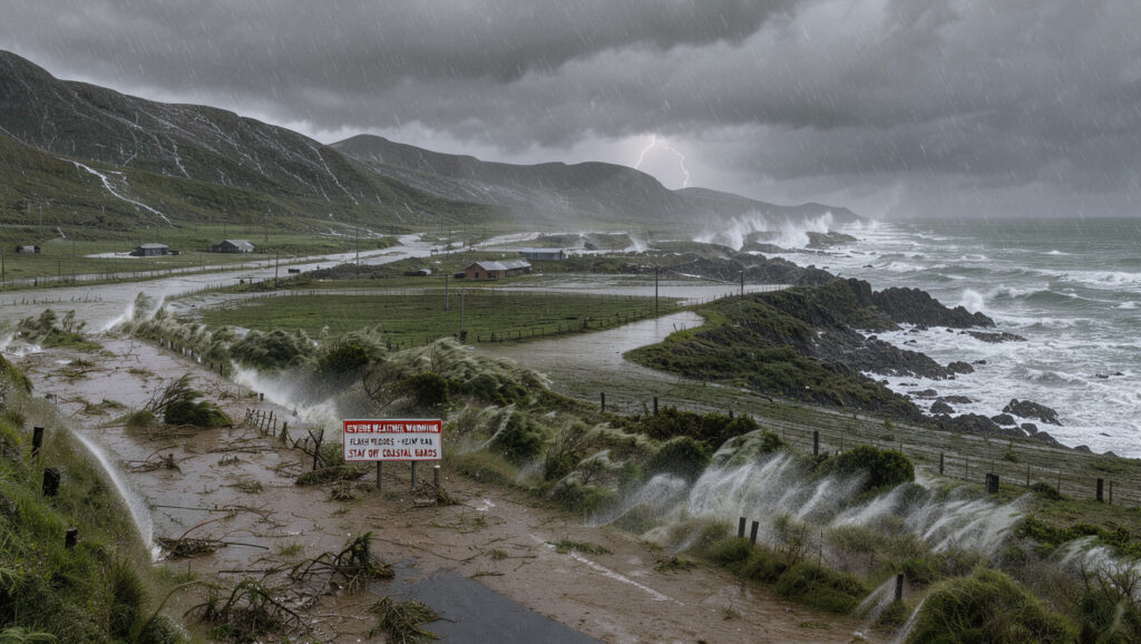
Coromandel Gisborne Heavy Rain: Warnings and Verified Totals
Heavy rain headlines for Coromandel and Gisborne often mix warnings, forecasts and old totals into one blur. This piece separates them, starting with the 488 mm that fell at Hikuwai during Cyclone Gabrielle in February 2023, according to MetService (national weather agency), and shows where the record is thin and why a forecast and a measured total are not interchangeable.
Red Rain Warnings, Cyclone Gabrielle: 5, per MetService (national weather agency) · Hikuwai maximum, Gabrielle: 488 mm, per MetService (national weather agency) · The Pinnacles, Gabrielle: 447 mm, per MetService (national weather agency) · Gisborne Airport, Gabrielle: 185.3 mm, per MetService (national weather agency)
Quick snapshot
- MetService issued five Red Rain Warnings during Cyclone Gabrielle in February 2023 (MetService (national weather agency))
- Hikuwai recorded 488 mm, the largest Gisborne-region total in the event, per MetService (national weather agency) (MetService (national weather agency))
- Gisborne Airport logged 185.3 mm before power and communications ceased, per MetService (national weather agency) (MetService (national weather agency))
- The sources behind this piece contain no rainfall records for Coromandel or Gisborne from 2019 to 2022 (SunLive (regional news site))
- A Red Rain Warning for Tairāwhiti/Gisborne is dated 22 June 2023, according to SunLive (regional news site)
- No recorded total is given for the orange warning of 6 January 2026 (Insurance Business NZ (insurance trade publication))
- Severe Weather Watches for Gabrielle began on 9 February 2023, and the first Red Warnings followed on 11 February 2023, per MetService (national weather agency) (RNZ (public broadcaster))
- Heavy rain warnings for Coromandel and northern Gisborne forecast up to 140 mm on 17 February 2025 (RNZ (public broadcaster))
- An orange warning for Gisborne/Tairāwhiti on 6 January 2026 covered up to 150 mm over about 22 hours, per Insurance Business NZ (insurance trade publication) (RNZ (public broadcaster))
- The most recent dated warning in these sources is the 6 January 2026 orange warning for Gisborne, per Insurance Business NZ (insurance trade publication) (MetService roles and responsibilities (official agency page))
- Heavy rain warnings apply when rainfall meets specified criteria, and severe weather warnings cover areas of roughly 1000 km² (MetService roles and responsibilities (official agency page))
Nine dated figures, one caution: the Gabrielle totals are measured at fixed stations, while the wider list mixes measured records with reported ones.
| Fact | Value |
|---|---|
| Red Rain Warnings, Cyclone Gabrielle | 5, per MetService (national weather agency) |
| First Red Warnings issued | Afternoon of 11 February 2023, per MetService (national weather agency) |
| Hikuwai, Gisborne: maximum rainfall, Gabrielle | 488 mm, per MetService (national weather agency) |
| The Pinnacles, Coromandel ranges: rainfall, Gabrielle | 447 mm, per MetService (national weather agency) |
| Gisborne Airport: rainfall before power cut, Gabrielle | 185.3 mm, per MetService (national weather agency) |
| Whitianga: rainfall, Gabrielle | 170.6 mm, per MetService (national weather agency) |
| Red Rain Warning, Tairāwhiti/Gisborne | 22 June 2023, according to SunLive (regional news site) |
| Gisborne Airport, January 2023 | 252 mm, its wettest January since 1937, according to SunLive (regional news site) |
| Whitianga Airport, January 2023 | 522.6 mm, its wettest January on record, according to SunLive (regional news site) |
What is the latest verified information about Coromandel Gisborne heavy rain?
The most recent dated warning in the sources behind this piece is an orange heavy rain warning for Gisborne/Tairāwhiti issued on 6 January 2026. Insurance Business NZ (insurance trade publication) reported it with up to 150 mm possible over about 22 hours, especially in the ranges. That figure is a forecast, and the sources include no measured total for the event.
Earlier, in February 2025, RNZ (public broadcaster) reported heavy rain warnings for the Coromandel Peninsula and Gisborne north of Tolaga Bay, forecasting up to 140 mm.
Latest dated warnings
- 6 January 2026: orange heavy rain warning for Gisborne/Tairāwhiti, up to 150 mm over about 22 hours (Insurance Business NZ (insurance trade publication))
- 17 February 2025: heavy rain warnings for Coromandel Peninsula and Gisborne north of Tolaga Bay, forecasting up to 140 mm (RNZ (public broadcaster))
- 17 February 2025: the Pinnacles recorded 200 mm in 24 hours, a figure a MetService meteorologist cited (NZ Herald (national newspaper))
- 25 December 2024: heavy rain warnings for Gisborne, Wairoa and Hastings, plus a severe thunderstorm watch for Coromandel Peninsula (Otago Daily Times (national daily newspaper))
The implication: Coverage of this topic leans heavily on forecasts, and the best-documented measured totals in these sources date from 2023. Check any new figure against its issue date before repeating it.
What should readers know first about Coromandel Gisborne heavy rain?
The biggest split in the record runs between the ranges and the coast, not between one town and another. During Cyclone Gabrielle, MetService (national weather agency) recorded 447 mm at The Pinnacles in the Coromandel ranges, compared with 170.6 mm at Whitianga. Gisborne shows the same gap, with Hikuwai logging 488 mm while Gisborne Airport recorded 185.3 mm.
A coastal station can understate what falls in the hills, so a warning for the ranges deserves more attention than the nearest town’s gauge suggests. The Gabrielle figures show the gap is wide, not marginal.
Regional pattern
- Coromandel ranges: The Pinnacles 447 mm, with other elevated Coromandel stations recording 220–270 mm, per MetService (national weather agency)
- Coromandel coast: Whitianga 170.6 mm during Gabrielle, per MetService (national weather agency)
- Gisborne ranges: Hikuwai 488 mm, the largest Gisborne accumulation in Gabrielle (Scoop (republished MetService press release))
- January 2023: NIWA reported 400–800% more rainfall than usual in parts of the Coromandel Peninsula (RNZ (public broadcaster))
The catch: A station reading is a point measurement, so one number from one gauge tells a reader little about the valley beside it. Compare the warning area with the gauge list before drawing conclusions.
Which official sources confirm key claims about Coromandel Gisborne heavy rain?
Start with the agency that issues the warning. MetService roles and responsibilities (official agency page) states that heavy rain warnings apply when rainfall meets specified criteria, and that severe weather warnings cover areas of roughly 1000 km² for heavy rain, strong wind and heavy snow. Every other claim should be checked against that baseline.
In June 2023, MetService chief executive Stephen Hunt wrote that a NIWA communication presented alternative views while omitting the official warnings in force (Otago Daily Times (national daily newspaper)). When public messages conflict, the agency warning is the one to check first.
MetService warnings
- Gabrielle warning record: five Red Rain Warnings, with Severe Weather Watches from 9 February 2023 and first Red Warnings on the afternoon of 11 February 2023, per MetService (national weather agency)
- Post-event update: by 15 February 2023 severe weather had eased in most places, but heavy rain continued through Thursday evening, per Scoop (republished MetService press release)
Regional and council updates
- During Cyclone Hale in January 2023, Tairāwhiti Civil Defence said peak rates of 15 to 25 mm an hour were possible (RNZ (public broadcaster))
- Council and civil defence updates describe local impacts such as slips and flooding, which the regional warning does not
What this means: Local updates help with road and flood impacts, but the warning level comes from MetService. When a local message and a MetService warning differ, the agency warning is the one to act on.
What is still unclear or unverified about Coromandel Gisborne heavy rain?
The sources behind this piece cover 2023 to 2026 and supply no rainfall records for these two areas from 2019 to 2022. Most of the more dramatic totals rest on a single secondary report each, so the lists below separate what is confirmed from what is still open.
Confirmed facts
- MetService issued five Red Rain Warnings during Cyclone Gabrielle in February 2023, per MetService (national weather agency)
- Hikuwai recorded 488 mm, the largest Gisborne accumulation in that event, per MetService (national weather agency)
- The Pinnacles recorded 447 mm in the Coromandel ranges, per MetService (national weather agency)
- Gisborne Airport recorded 185.3 mm before power and communications ceased, per MetService (national weather agency)
What’s unclear
- A Red Rain Warning for Tairāwhiti/Gisborne was issued on 22 January 2023, according to SunLive (regional news site), and the supplied sources include no MetService archive page for that date
- Whitianga Airport recorded 522.6 mm in January 2023, its wettest January on record, according to SunLive (regional news site)
- Gisborne’s potable water supply was disrupted with “Stop using Water” alerts during Gabrielle, according to Wikipedia (encyclopedia)
- The 150 mm figure for January 2026 is a forecast, and no recorded total for that event appears in these sources, per Insurance Business NZ (insurance trade publication)
- The Pinnacles’ 200 mm in 24 hours in February 2025 is a single quoted figure, with no station record in this set to check it against, per NZ Herald (national newspaper)
The catch: The confirmed list is the part safe to quote in full. Anything in the open list needs its issue date and originating source before it appears in a story.
Which heavy rain questions do people ask most about Coromandel and Gisborne?
The questions this topic raises tend to fall into three groups, and the sources here answer the first two with dated material. The third needs the checks described below.
- What a warning level means: heavy rain warnings are tied to rainfall criteria set out by MetService, per MetService roles and responsibilities (official agency page)
- How much rain has fallen: the best-documented measured records are from Cyclone Gabrielle in February 2023, per MetService (national weather agency)
- Whether a number is measured or forecast: forecast totals such as 150 mm for January 2026 are not recorded totals, per Insurance Business NZ (insurance trade publication)
A forecast can read like a record. The 150 mm forecast for Gisborne in January 2026 sits next to 488 mm measured at Hikuwai in February 2023, but only the second is a finished count, per MetService (national weather agency).
What this means: A figure is only as reliable as its date and its source. Attach both to any number before it is repeated.
Timeline signal
The dated events below run from Cyclone Hale in January 2023 to the most recent forecast in this set, with the strongest documentation sitting in the Gabrielle period.
- 10 January 2023: MetService Heavy Rain Warnings remained in place for Coromandel Peninsula and Gisborne on Tuesday night during Cyclone Hale (RNZ (public broadcaster))
- 9 February 2023: MetService began Severe Weather Watches for Cyclone Gabrielle, per MetService (national weather agency)
- 11 February 2023: first MetService Red Warnings issued, on the afternoon of that day, per MetService (national weather agency)
- 15 February 2023: Gabrielle’s severe weather eased in most places, but heavy rain continued through Thursday evening, per Scoop (republished MetService press release)
- 22 June 2023: Red Rain Warning for Tairāwhiti/Gisborne, according to SunLive (regional news site)
- 23 June 2023: MetService issued a Red Warning for Gisborne during a local state of emergency and evacuations, per Otago Daily Times (national daily newspaper)
- 25 December 2024: heavy rain warnings for Gisborne, Wairoa and Hastings, per Otago Daily Times (national daily newspaper)
- 17 February 2025: heavy rain warnings for Coromandel Peninsula and northern Gisborne, up to 140 mm, per RNZ (public broadcaster)
- 6 January 2026: orange heavy rain warning for Gisborne/Tairāwhiti, per Insurance Business NZ (insurance trade publication)
The pattern: Warnings recur in every year covered here, and most arrive with a forecast figure rather than a finished total.
What the people involved said
Three named speakers in these sources show how warnings and figures reached the public.
“Each time, they failed to mention the official severe weather watches and warnings which were in force, and instead presented Niwa’s alternative views.”
Stephen Hunt, MetService chief executive, in a letter to NIWA, as reported by Otago Daily Times (national daily newspaper)
“We’ve already seen 200mm of rainfall recorded at the Pinnacles on the Coromandel Peninsula over the last 24 hours”
Katie Hillyer, MetService meteorologist, in NZ Herald (national newspaper)
“We’ve got widespread flooding, we’ve got a number of slips all the way from Hikuai all the way up to Whitianga.”
Garry Towler, Thames Valley Civil Defence controller, in RNZ (public broadcaster)
The implication: The agency and the local responders described the same storm in the same terms. When official and unofficial voices diverged, as they did in 2023, the public record became harder to read.
What this means for readers
The 2023 record already shows how official and unofficial numbers can collide, and the 2025 and 2026 forecasts show how quickly a new figure can circulate. For Coromandel and Gisborne residents, the choice is clear: follow the MetService warning and check council figures against it, or repeat a headline total whose date and station you cannot confirm.
Related reading: New Zealand strong winds and rain warnings
Related reading: New Zealand strong winds and rain warnings
metservice.com, about.metservice.com, aotearavoice.nz, 1news.co.nz, odt.co.nz, rnz.co.nz, rnz.co.nz, rnz.co.nz
Frequently asked questions
How do heavy rain warnings differ from heavy rain watches?
MetService ties heavy rain warnings to specified rainfall criteria, and its severe weather warnings cover areas of roughly 1000 km², per MetService roles and responsibilities (official agency page). The sources here do not spell out watch thresholds, so check the wording on the current MetService warning.
How much rain fell on the Coromandel Peninsula during Cyclone Gabrielle?
The Pinnacles recorded 447 mm and Whitianga recorded 170.6 mm during the cyclone in February 2023, per MetService (national weather agency).
Which areas received Red Rain Warnings during Cyclone Gabrielle?
MetService issued five Red Warnings for rain covering Northland, Auckland, Coromandel, Gisborne and Hawke’s Bay, per MetService (national weather agency).
Where should residents look for official heavy rain updates for Gisborne?
Start with MetService warnings, which set the warning level, per MetService roles and responsibilities (official agency page). The sources behind this article include no council web address, so none is linked here.
How long did heavy rain continue after Cyclone Gabrielle eased?
By 15 February 2023 MetService said severe weather had eased in most places, but heavy rain continued through Thursday evening, and Gisborne rainfall fell on saturated soil, per Scoop (republished MetService press release).
Did the January 2026 Gisborne warning produce recorded totals?
The sources report a forecast of up to 150 mm over about 22 hours, per Insurance Business NZ (insurance trade publication). They include no measured total for that event, so no recorded figure is confirmed yet.
More related posts
 TP-Link WiFi Extender – Best Models Setup and Troubleshooting
 Easy Appetizers for Parties: No-Cook Make-Ahead Ideas
 What Does 444 Mean? Angel Number, Bible & Love Guide
 FireFly Metals Share Price: Analysis, Targets & Outlook
 PLS ASX Share Price – Live Data, Charts and Analysis
 Lilo & Stitch Movie: Age Rating, Streaming, and More
 Boxer Dog Breed: Temperament, Health, Pros and Cons
 Places to Visit in Taupo: Attractions, Gems & Budget